Sharpen Your Wilderness Navigation Skills: A Detailed Guide for Adventurous Explorers Without GPS
Mastering the intricate skills of wilderness navigation without the aid of modern technology may seem daunting at first glance. However, developing fundamental map and compass navigation skills can transform your outdoor experiences, making them far more enriching and enjoyable. At the core of successful navigation is a deep understanding of your natural surroundings, along with the ability to pinpoint your location in relation to your intended destination. A map serves as a detailed two-dimensional representation of the landscape, while a compass provides a trustworthy method for orienting yourself according to the cardinal directions: north, south, east, and west. By mastering these essential tools, you can confidently venture into the great outdoors, free from reliance on technological devices.
To embark on your navigation journey effectively, you should immerse yourself in the myriad symbols and scales depicted on a map; these elements are critical for accurately interpreting the physical landscape. A thorough understanding of how to read contour lines that represent elevation changes is essential, as it enables you to identify hills, valleys, and other geographical features that could influence your chosen route. Furthermore, becoming skilled in compass usage is equally important, as it equips you to navigate through the wilderness successfully without the crutch of GPS devices.
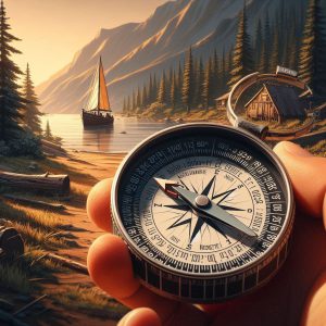
The compass needle consistently points toward magnetic north, allowing you to align your map with the actual terrain. To accomplish this, hold the compass level in your hand and rotate the map until the magnetic north indicated on the compass aligns with the north shown on the map. This fundamental process, known as “orienting the map,” is crucial for maintaining accuracy in your navigation efforts, ensuring that you stay on the correct path as you explore.
Once the map is correctly oriented, you can use the compass to take bearings that will guide your travel direction. By effectively integrating these two powerful navigational instruments—the map and the compass—you will gain the confidence needed to traverse unfamiliar landscapes, ensuring that you remain on track even in the absence of modern technological tools.
Key Principles for Achieving Success in Outdoor Navigation
- Developing proficiency in map and compass navigation is essential for anyone engaging in wilderness exploration or various outdoor activities.
- Topographic maps deliver intricate details about the terrain, elevation, and natural features, which are crucial for effective navigation.
- A compass not only indicates direction but also facilitates navigation by aligning with the map’s orientation and understanding magnetic north.
- Natural landmarks and indicators, such as distinctive rock formations or unique tree arrangements, can serve as valuable navigational aids when a map or compass aren’t available.
- Estimating distance and travel time is vital for planning and executing a successful navigation strategy in the wilderness.
 The Essential Function of Topographic Maps in Wilderness Navigation
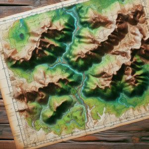
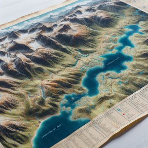
Topographic maps are invaluable resources for anyone planning an expedition into the wilderness. These maps contain extensive information regarding the physical characteristics of the terrain, employing contour lines to illustrate changes in elevation. This visual representation allows you to understand the landscape’s shape and steepness, preparing you for the challenges that lie ahead. Each contour line connects points of equal elevation, and the proximity of these lines reveals whether the slope is steep or gradual, providing you with the essential knowledge needed for effective navigation.
Understanding Contour Lines and Map Symbols for Proficient Navigation
As you examine a topographic map, it is vital to carefully analyze the patterns created by contour lines; closely spaced lines indicate steep terrain, while widely spaced lines signify flatter areas. This understanding empowers you to anticipate potential obstacles along your chosen route, allowing for informed navigation decisions. Additionally, topographic maps are rich with symbols that represent various landmarks, including rivers, roads, trails, and different types of vegetation. Becoming familiar with these symbols lays the foundation for effective navigation, ensuring you can utilize the map to its fullest potential.
Mastering Navigation Techniques with Topographic Maps
For instance, blue lines typically indicate the presence of water bodies, such as streams or lakes, while green areas may represent forests or dense vegetation. By correlating these symbols with your surroundings, you can validate your location and make necessary adjustments to your route. Moreover, topographic maps often feature grid lines that assist you in pinpointing coordinates, allowing for even greater precision in navigation. By mastering the subtleties of topographic maps, you will enhance your appreciation for the landscape while improving your overall navigational skills in the wild.
 Utilizing a Compass for Accurate Directional Navigation
A compass is an indispensable tool for any adventurer, providing invaluable assistance in directional navigation, especially when traversing unfamiliar landscapes. To effectively use a compass, begin by holding it level in front of you and allowing the needle to stabilize. The needle will point toward magnetic north, which may vary slightly from true north due to magnetic declination—the angle between magnetic north and true north can change based on your geographical location.
Before embarking on your journey, it’s crucial to determine the local declination and adjust your compass accordingly. This adjustment is vital for maintaining accurate bearings, ensuring that you stay on course throughout your adventure. Once your compass is calibrated for declination, you can proceed to take a bearing that will guide your direction of travel.
To take a bearing, identify a landmark you wish to navigate toward and rotate the compass housing until the orienting arrow aligns with the magnetic needle. The degree reading on the compass dial that aligns with the index line indicates your bearing. As you move toward your destination, periodically check your bearing to ensure you remain on the correct path.
If you find yourself deviating from your intended course, reorient your compass and adjust your path as needed. By mastering these techniques, you will gain confidence in using a compass as a reliable navigational tool during any outdoor adventure.
 Leveraging Natural Landmarks and Signs for Efficient Wilderness Navigation
While maps and compasses are critical navigational tools, observing natural landmarks and cues can significantly enhance your capacity to navigate the wilderness effectively. Distinctive features such as mountains, rivers, or unique trees serve as invaluable reference points when traversing unfamiliar terrain. For instance, if you know a specific mountain lies to the east of your starting position, you can use it as a reliable guide to ensure you’re heading in the correct direction.
Moreover, familiarizing yourself with the unique characteristics of your surroundings will assist in forming mental maps, allowing you to navigate without solely relying on tools. In addition to prominent landmarks, pay close attention to natural signs that may indicate direction or changes in terrain. The position of the sun can serve as a helpful guide; in the northern hemisphere, the sun rises in the east and sets in the west, providing a general sense of direction throughout the day.
Furthermore, observing moss growth on trees—often more abundant on the north side—can provide valuable clues about orientation in dense forests. Animal trails can also provide directional hints; many animals follow established paths that can lead you toward water sources or other significant landmarks. By refining your ability to interpret these natural signs, you will enhance your skills in navigating diverse environments.
Estimating Distance and Travel Time for Efficient Wilderness Navigation
Accurately estimating distance and travel time is crucial for successful navigation in wilderness areas. Understanding how far you have traveled and the expected time to reach your destination allows for better planning and helps avoid unforeseen challenges. One effective technique for estimating distance involves pacing—counting your steps as you walk.
On average, an adult’s stride measures approximately 2.5 feet, meaning that by counting your steps over a known distance, you can gauge how far you’ve traveled based on your pace. Additionally, consider the type of terrain and elevation changes when estimating travel time. For instance, traversing flat ground typically allows for quicker movement compared to navigating steep hills or rocky paths.
A common guideline suggests that you can cover roughly three miles per hour on flat terrain, but this estimate should be adjusted significantly when encountering challenging landscapes. By factoring in these variables and modifying your expectations accordingly, you will be better prepared for your journey and more capable of managing your time effectively.
Creating a Well-Structured Wilderness Route and Navigation Plan
Crafting Your Wilderness Route for Optimal Navigation Success
Formulating an effective navigation plan is crucial before embarking on any wilderness adventure. Begin by analyzing topographic maps of the area you intend to explore, pinpointing potential routes based on prominent landmarks, existing trails, and available water sources. As you construct your route, consider factors such as elevation changes and terrain difficulty; ensuring your plan is realistic and achievable is of utmost importance.
Preparing for Unexpected Obstacles and Weather Variability
While planning your route, it’s wise to consider alternative paths in case you encounter unforeseen obstacles or abrupt shifts in weather conditions. Having multiple options will provide you with greater flexibility during your journey and contribute to your overall safety. This adaptability is essential for a successful and enjoyable wilderness experience, empowering you to navigate any challenges that may arise seamlessly.
Developing a Comprehensive Navigation Strategy
Once you’ve mapped out potential routes, develop a detailed navigation plan that includes key waypoints. Mark these waypoints on your map, and if possible, note their coordinates, allowing you to track your progress as you navigate through the wilderness. Additionally, incorporate estimated travel times between waypoints and identify any potential hazards that may arise along your chosen route.
Ensuring a Safe and Fulfilling Outdoor Experience
Thorough planning and anticipating challenges significantly enhance your chances of reaching your destination while enjoying a safe and fulfilling outdoor experience. A well-organized navigation strategy is vital for a successful wilderness adventure, ensuring you can explore the great outdoors with confidence and assurance.
 Implementing Emergency Navigation Techniques for Unforeseen Circumstances
Despite careful planning and preparation, unexpected circumstances may arise during outdoor adventures that require emergency navigation techniques. A crucial skill is the ability to backtrack; if you find yourself lost or disoriented, retracing your steps can often lead you back to familiar territory. To execute this effectively, pay close attention to distinctive landmarks or features along your route, which can serve as reference points when returning.
Another invaluable technique is celestial navigation, particularly useful when visibility permits—especially on clear nights or sunny days when stars or celestial bodies are visible. Familiarizing yourself with prominent constellations, such as the North Star (Polaris) in the northern hemisphere, can provide guidance, as it remains relatively fixed in position while other stars shift. By locating Polaris and determining its angle above the horizon, you can ascertain true north without relying on a compass or map.
If you have a wristwatch or smartphone as a backup, utilizing it alongside celestial navigation can bolster your sense of direction during emergencies, helping you maintain your orientation even in challenging situations.
Boost Your Wilderness Navigation Skills: Practical Strategies for Continuous Improvement
Enhancing your wilderness navigation skills requires dedication and practice, but the rewards can greatly enrich your outdoor experiences. One effective strategy is to join local hiking groups or outdoor clubs, where members can share their knowledge and experiences related to navigation techniques. Engaging with seasoned navigators can provide valuable insights into best practices while offering hands-on learning opportunities across various terrains.
Another advantageous approach involves regularly practicing with maps and compasses in diverse environments—be it urban settings or remote wilderness areas—to build your confidence in these essential skills. Set aside time for solo excursions where you intentionally navigate without technological aids; this method reinforces your abilities while allowing you to connect more deeply with nature. Furthermore, consider maintaining a navigation journal to document routes taken, challenges faced, and lessons learned during each adventure; this reflective practice enhances your skills and deepens your appreciation for navigating diverse landscapes.
By embracing these techniques and continuously refining your skills in map reading, compass usage, natural observation, distance estimation, route planning, emergency strategies, and sharing practical experiences with others, you will evolve into a more self-assured navigator, capable of thriving in any wilderness environment, even without the support of technology.
Common Questions About Wilderness Navigation Techniques
What does wilderness navigation involve?
Wilderness navigation encompasses the skills and techniques needed to determine and maintain a route through natural, often remote, and undeveloped areas. It includes utilizing various tools and methods to stay on course and safely reach a desired destination.
What traditional methods are used in wilderness navigation?
Traditional wilderness navigation methods include using a map and compass, interpreting topographic features, observing natural landmarks, and applying celestial navigation techniques based on the sun, moon, and stars.
Why might someone prefer to navigate without GPS?
Many individuals choose to navigate without GPS for a variety of reasons, including the desire to enhance their wilderness navigation skills, embrace the challenge of traditional methods, or prepare for potential GPS malfunctions or limited access to technology.
What benefits come with learning wilderness navigation without relying on GPS?
Learning wilderness navigation techniques independent of GPS can deepen one’s understanding of the natural environment, increase self-reliance and confidence, and provide a dependable backup plan in case of technology failures or restricted access to GPS devices.
What challenges may arise when navigating in the wilderness without GPS?
Challenges related to wilderness navigation without GPS include the necessity for advanced planning, the potential for human error, and reliance on environmental factors such as weather and visibility conditions.
The post Wilderness Navigation Techniques Without GPS appeared first on Survival Bite.
The Article Wilderness Navigation Techniques for Off-Grid Adventures Was Found On https://limitsofstrategy.com
The Article Wilderness Navigation Techniques for Off-Grid Explorers First Appeared ON
: https://ad4sc.com


Your exploration of wilderness navigation without GPS truly resonates with me. In a world where we often rely on technology, rediscovering these fundamental skills feels not only empowering but necessary for truly immersive outdoor experiences. I recall my first solo hiking trip where I relied solely on a map and compass; the sense of accomplishment I felt upon reaching my destination—especially after traversing unfamiliar terrain—was exhilarating. It’s fascinating how mastering these tools can deepen our connection to nature, encouraging us to observe details that we might overlook when following a digital path.
It’s really great to hear about your experience with solo hiking and relying on a map and compass. There’s something undeniably special about navigating without the aid of technology. The moment you step into the wilderness with just those simple tools can feel a bit like opening a door to a different way of interacting with the world around you.
Your reflection on the empowerment of wilderness navigation without GPS really highlights something vital in our relationship with the outdoors. The shift towards technology can sometimes obscure the rich experiences that solo skills—like using a map and compass—bring to our adventures. Growing up, many of us were taught to navigate using the landmarks around us, which feels deeply rooted in our interaction with nature. Yet, with GPS readily available, those skills have been somewhat sidelined.
You brought up some really interesting points about the balance between technology and traditional navigation skills. I completely agree that relying on GPS can sometimes take us away from those rich, immersive experiences that come from reading a map and connecting with our surroundings. There’s something profoundly grounding about using a compass and recognizing landmarks, like trees or mountains, that really connects us to the land.
I totally get where you’re coming from. There’s something special about relying on just a map and compass. It really shifts your focus on the environment around you, doesn’t it? Every little detail—the way the trees align, the slope of the ground—starts to matter. It’s almost like the landscape becomes a character in your adventure.
This is such an important topic! I remember my first solo hike where I relied completely on a map and compass—no GPS in sight. It was a bit nerve-wracking at first, but once I got the hang of it, I felt such a strong connection to the environment around me. It’s like tuning into a frequency that GPS just can’t provide.
Your exploration of wilderness navigation skills has struck a chord with me, as I believe this topic intertwines deeply with not just our ability to traverse the wild, but also with our connection to nature and the art of self-reliance. In a world increasingly dominated by technology, the idea of disconnecting from our devices to immerse ourselves in the natural environment is both refreshing and crucial.
I really resonate with what you’ve said about the connection between wilderness navigation and our bond with nature. It’s fascinating how skills that once were so fundamental to survival have become almost niche interests in today’s tech-saturated world. There’s something profoundly grounding about stepping away from our devices and allowing ourselves to be fully present in nature.